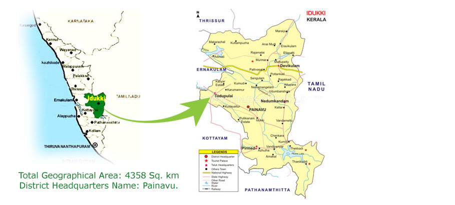

| 1.1 | Population | |
| Male | 5,52,808 | |
| Female | 5,56,166 | |
| 1.2 | Literacy rate (%) | |
| Male | 95 | |
| Female | 89 |
| Name of Taluk | Number of Villages | |
| 1)Devikulam | 13 | |
| 2)Thodupuzha | 17 | |
| 3)Udumbanchola | 18 | |
| 4)Peermade | 10 | |
| 5)Idukki | 9 |
| Name of Block | |
| 1) Adimaly | |
| 2) Devikulam | |
| 3) Nedumkandam | |
| 4) Elamdesam | |
| 5) Idukki | |
| 6) Kattapana | |
| 7) Thodupuzha | |
| 8) Azhutha |
| Agro Ecological Region and subregion(ICAR) | Western Ghats And Coastal Plain, Hot Humid Region (19.2) | |||
| Agro-Climatic Region & Sub-agro climatic region (Planning Commission) | Western Plain and Ghat Region (XII), Hilly Sub Region | |||
| Agro Climatic Zone (NARP) | High altitude zone (KE-4) | |||
| List all the districts or part thereof falling under the NARP Zone | Idukki and Wayanad | |||
| Geographic coordinates of district | Latitude | Longitude | Altitude | |
| 9° 51′ 0″ N | 76° 56′ 24″ E | 600 m above MSL | ||
| Name and address of the concerned ZRS/ ZARS/ RARS/ RRS/ RRTTS | Cardamom Research Station, Pampadumpara | |||
| Mention the KVK located in the district | ICAR Krishi Vigyan Kendra, Bapooji Sevak Samaj, Santhanpara P.O, Idukki- 685619 | |||
| Name of Block | |||||
| Rainfall | Average RF (mm) | Normal Rainy days (number) | Normal Onset | Normal Cessation | |
| SW monsoon (June-Sep) | 735.10 mm | 106 | June 1st week | September 1st week | |
| NE Monsoon(Oct-Dec) | 880.40 mm | 73 | October 1st week | November 3rd week | |
| Winter (Jan- March) | 222.3 mm | 35 | – | – | |
| Summer (Apr-May) | 508.10 mm | 73 | – | – | |
| Annual rainfall | 2345.90 mm | 287 | – | – |